9th Annual Jeep-CJ Trail REPORT

9th Annual Jeep-CJ Trail REPORT

BusaDave9

Always Off-Roading Jeeper
Posts
8,244
Thanks
81
Location
Durango, Crawlarado
Vehicle(s)
1979 Jeep CJ5 with 304 V8, T18 Transmission, Dana 20 Transfer case with TeraLow 3:1 gears, 4.88 axle gears, Detroit Locker up front and Ox Locker in back with 1 piece axle shafts, 36" SuperSwamper SX Tires, Shackle reversal, MileMarker Hydraulic winch, MSD 6A ignition.
This was the 9th year for the Jeep-CJ Colorado trail ride. I was able to obtain a permit to go over Black Bear Pass in the reverse direction. That permit became worthless because Black Bear pass has not opened due to snow and the shelf road is washed out. Last year the mountains received more snow than anyone has remembered falling in this area. There were also a record number avalanches leaving a lot of debris on some trails.

We had 13 off road vehicles and about 26 people participate this year. I hate to say it but I won't be hosting a Colorado Trail ride next year. We'll have other trail rides around the country such as one at the Rubicon in California. It's better if we trade off where in the US the trail rides will be. The Colorado Trail Ride has been going on for 9 years and I feel it may detract participants from joining the other trail rides. I will be hosting a Colorado Trail Ride in 2021. In that year we will be using Silverton as our base.

I also want to express my sincere appreciation of Posi and his assistance in making this another great week of trail rides. I asked him to help lead some trail rides. Posi researched and found several trails I have never led people on for any of the Jeep-CJ trail rides. I have followed him on some of these trail rides. He found some unique trail rides near our base in Ouray. A million thanks to Posi.

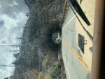
This year my nephew flew out for the trail ride. I picked him up at the Durango airport on Saturday August 3rd. We headed north on highway 550. We had motel reservations at The Angler Inn on highway 145 near Telluride. I made reservations there thinking we'd be going over Black Bear Pass in the reverse direction. I kept the reservations even after realizing we'd never be able to go over Black Bear Pass.

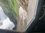
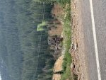
To get to our motel we left highway 550 and turned onto Ophir Pass trail. We locked the hubs and Jake took over the driving.

48511840817_0b07a79449_b.jpg


We checked into our motel at the Angler Inn.

48511651481_a36b4380d2_b.jpg


Then we went to Telluride for dinner. After dinner we took the free Telluride Tram to the top of the mountain.

48511659831_045a021e41_b.jpg


48512720397_5a4105fac9_b.jpg


The motel for the rest of the week is over the mountains in Ouray but this is our home for the night.

The other participants can add to my thread or start their own. It really doesn't matter to me.

To be continued ...
 
It was a great trip! I plan on exploring more of this area in the future. Here is a few pictures off of 550 “million dollar highway”
 

Attachments

  • 814F1E54-F709-413D-A8BD-B6473B6AEA59.jpg
    814F1E54-F709-413D-A8BD-B6473B6AEA59.jpg
    20 KB · Views: 62
  • 2EC329A9-0EA6-4FD8-A46D-35EABCFB7EC2.jpg
    2EC329A9-0EA6-4FD8-A46D-35EABCFB7EC2.jpg
    19.9 KB · Views: 37
  • DD3C087E-7309-4FAF-8BE6-9F6C53BF9699.jpg
    DD3C087E-7309-4FAF-8BE6-9F6C53BF9699.jpg
    19 KB · Views: 26
IMG_3894.jpg

IMG_3830.jpg

IMG_3824.jpg
 
Last edited:
Many thanks to Dave for hosting this event for all of us to enjoy. I totally enjoyed this time with good friends. Again, thanks Dave!

529415a82c4861e31259b385214ab7fa.jpg

74a225a4b2f3668021206a61e84757c6.jpg

5843fd3ae54f072e93036a31b3f906db.jpg

ce31851b7d614ea9501115a098230a0e.jpg

2cb13a35f0bcbce2aa9f371b8ca8f3d4.jpg

c2524175ed2032a3871c92db8a39bd53.jpg

a38dc94234d761f798c4b4a154910b96.jpg

abd46b49aa39d7de326a230f46610100.jpg

8bf968f3be799d1f2b8c1ee50218ba17.jpg

2c4223361dbbccfb90de3da2ea136a96.jpg

bbe4fced37dd36d1c8759e3a836fee4e.jpg

5e972a5ed6fff6a92afb257bbdc7ec90.jpg

767d606b7f04dc2518f06d304a367b3d.jpg

ba7c1b03ca0110d857a50a0e9f12360c.jpg

519569c878fc17345358bbd0a99ab19b.jpg

74fd93eece7f75a178a9738066e0ee2b.jpg

1bd526d98ba34b535add69a54ccc4cb8.jpg

4a4dbeb5574644218189a357d3eb1bad.jpg

899153c22ef11bbb1a574cf4bfd42dd0.jpg

3621b6d4ece66d9a242c750b3ddd36ff.jpg

84f6720de61ece224c15e53681ac646e.jpg

c794df96684fb0c729f7a613c9137fac.jpg


Sent from my iPhone using Tapatalk
 
Sunday August 4th

After breakfast we headed over the mountains on Imogene Pass trail.

48511651306_600e2cb188_b.jpg

48511831582_259e4c7e5a_b.jpg

Then we came upon Tom Boy. This used to be a mining town with a school and a daily stagecoach.

48511650786_c8810e0d15_b.jpg

48511831072_545be7a841_b.jpg

Then we continued on to Imogene pass

48511840147_516be9273b_b.jpg

48511659156_76c4051f37_b.jpg

48511658851_8f3de60ffa_b.jpg

The route we took went to the top of a cliff overlooking Camp Bird Mine. There is also a shortcut that goes right through this mine.

48511839157_65cfc9daeb_b.jpg

The Camp Bird Road has this shelf road with an overhang above the road.

48511657941_cac6673585_b.jpg

48511838122_50bba0136a_b.jpg

Then we arrived at our motel in Ouray. Tomorrow we'll be joining the rest of the group on the trail.

To be continued ...
 
How did the carb'd engines do at 13K'+ASL?
LG
 
I received feedback concerning the Sound Democrat Mine many thought it was the best Mine they visited. It was one of many good Mines in the area available to us.

3ae1b7131ed599d15a70cece6947e593.jpg

8633e7516bea567211c63a8f628e51cb.jpg

d0c4684a80614928e54b97772599adb2.jpg

d998ccd9e062d87ed24b9ba30d60ce71.jpg

d4d61b46d21df66bb96df971248cf531.jpg

351ff5619e4b1be130707ebb519e5d17.jpg

96be9517ced5424342bfebd015ab1de0.jpg

34520301f990d8b490fb11397526a192.jpg

f44c2a0590cac2e60d0453d7b072df98.jpg

bc6dcd3c710370cea91b6d2f7ea8c931.jpg


Sent from my iPhone using Tapatalk
 
Last edited:
Heres a few more pictures of the sound democrat minea88b1813b860a97e1b0d105277101301.jpg1a7e5b4e00c35dd6b67920e8af54fd2c.jpg98511404a85adf15a224661abddeef2f.jpg
 
One more picture
4a8566ece8789d06eca0691373e759c6.jpg


Sent from my iPhone using Tapatalk
 
How did the carb'd engines do at 13K'+ASL?
LG

I change the jets here at home before I go.
More likely problem is vapor lock.
When crawling along engine temps can rise with little to no air movement in some of the canyon bottoms.
Most driving is done in low range to climb the steep grades.
 
Fresh cut path above the mill another picture of the mountain range around the mine
7b5fba556a6a5abd02a8c14b5f32e9d9.jpga92ccb22baca96981d362f581e7cced9.jpg


Sent from my iPhone using Tapatalk
 
Monday August 5th

Monday was the first say of organized trail rides. We left Ouray and headed south for 3 miles before turning off the highway and onto Lower Engineer Pass trail. We stopped here to lock the hubs.
Today we all traveled in one group of 13 jeeps.

48511656741_35a5926422_b.jpg

We stopped at the Michael Breen Mine.

48511656296_33cd8d3e59_b.jpg

48511655701_ace9c73578_b.jpg

Next we took a detour to Mineral Point. This is another mining site.

48511655271_af380643b2_b.jpg

48511835517_7170583b27_b.jpg

48511834937_eec2b3a695_b.jpg

We stopped at Odom Point for a group shot. Some maps call this Oh! Point.

48511653921_451a192989_b.jpg

Then we went to Animas Forks Ghost town.

48511653471_91200c69de_b.jpg

The direct road to Silverton is blocked by the snow of a large avalanche so we headed into California Gulch.

48511653001_3fa194a846_b.jpg

The top of California Gulch still has lots of snow in August.

48511833082_6fc3299c43_b.jpg

Here's Rad taking a picture of the sign at the top of California Pass.

48511652151_c28e119d4b_b.jpg

After California Pass we didn't descend much before reaching Hurricane pass. On our decent I took this picture of Storm Peak.

48511832412_a7e0941b52_b.jpg[/url]

We took Corkscrew Pass to get back to the highway.

48511830337_b6d70d44f6_b.jpg

48511843922_c16e471287_b.jpg

The above picture was taken August 5th. For comparison here's the picture I took July 18th going the opposite direction. You can see how much snow has melted.

48319509006_f5a2623247_b.jpg

Although the snow is melting the debris still shows the power of the avalanches. The size of the trees also show how rare these avalanches are. Trees don't get very big where avalanches are common.

48511663091_c2628bca82_b.jpg

We made it back to Ouray.

To be continued ...
 
Monday’s London Mine visit.

b61f301ea87e79820cb8fc48e25203a8.jpg

71e0b9c83fa3fc09518c4cc1bb281735.jpg

d8f6574520d3eb8944ddde5189c3d887.jpg

10cac1a6ad9b8ef4e5c74376f1759649.jpg

0a780448e3c12b559a08f73cadfcc720.jpg

d3f45e869b43be2e95a248804af3c2d6.jpg

ae6a0c5514facf1e8402c4bc76d36dc9.jpg

d16e1454be28410d0763df787c887c5f.jpg

6a8dc7b2039803d67b93fe9b5ce3c183.jpg

376a2b4bd214fee2e70a054fd2e661c7.jpg

4e8e17723344d75ca46948afa721696e.jpg

a54533d25982772ca20f4f2207cdc2a5.jpg


Sent from my iPhone using Tapatalk
 
Tuesday August 6th

Today we left Ophir and headed out on Imogene Pass trail.

48511662696_0fdd5e51d7_b.jpg

Jake drove my Jeep.

48511662046_c3b2464c6c_b.jpg

48511661641_b8da6359d1_b.jpg

This next picture is looking toward Telluride.

48511661156_277fdb3b02_b.jpg

48511660781_f31989ebe4_b.jpg

This next picture shows Black Bear Pass zig zagging it's way down the mountain. You can also see Bridal Veil Falls, the highest waterfall in Colorado.

48511683301_89de926d4c_b.jpg

From Telluride we went on the highway for a few miles then took Ophir pass to get back.

To be continued ...
 
We ran Imogene trail then Last Dollar Trail back to Ouray.

At Imogene Pass we found the weather so nice we stayed for lunch before heading to Telluride.

We were surprised at the lack of wind and the warm sun at 13k on Imogene Pass so we hung out for 30-45 mins before moving on.

3d9012bc4dd86f9fa782811887706d5a.jpg

89aad461ecb9dfb840163d5258f2e963.jpg

6e044536f472000948e11c98816a87d1.jpg

e738c790e7b7047ea7d1462829342416.jpg

88dbf1bf43ecab3844799dd26acdad9a.jpg

20918458e5a7ac9a01fb6e4e0670a147.jpg

6b5d62b2c3f3652efa5c06ad724ddd82.jpg

6dff0826763aa1b5243e4f64bf1b9bd1.jpg

20a57053602a5f0fde4e1dbabf0a7cbc.jpg

076b202ef92321c7772028637d5b0a91.jpg

965ef0f89a00a7bf9f5111ab465308f1.jpg

0ddb034f86562529001a6b671b80a808.jpg

Last Dollar

f143b7d7e6781a7060cbe472d1864b3b.jpg

e7659eaf7d42497c58b0cb9249d92096.jpg


Sent from my iPhone using Tapatalk
 
Heres some more pictures to add to your post Posi
c17d645a286ffd00f3e0f7d270a690b1.jpg3ff3c6877571e24e371d0c5fc6f437c1.jpgf55d4cac67afb88baa50015f5a9dab78.jpg90fb7e7dd780b023b49997ca5496649e.jpg


Sent from my iPhone using Tapatalk
 
I've got quite a few photos to add, and have talked my Uncle into joining the site too to post his / theirs.

Just crazy at work at the moment to take the time to do it....

Soon... :drool:

:chug:
 
Beautiful scenery ! Great pictures ! Thanks for sharing with those who were unable to go. Just makes me want even more to get there.
 
Oh wow!!!! What a beautiful country we live in.
I wish I wasn't thousands of miles away so I could experience some of what you guys got to see first hand.
Thanks for the pics, they were AWESOME!!!!!
 
Wednesday August 7th

Today we went up Corkscrew Pass then on to Hurricane Pass.
Here's a tipple on Hurricane Pass.

48511864002_eb1b4bd6a0_b.jpg

A tipple is a structure that is used to load ore into a rail car or some other form of transportation.

Here is Cory's (MtnBiker4evr13) CJ7

48511682296_1924d7de9a_b.jpg

Next we turned up Placer Gulch. The web site for the Forest Service said this trail just opened the day before. It seemed to be in good shape. This leads to Picayune Gulch and that was recently opened. I think the Forest Service didn't want people driving across these gulches to find a dead end and have a long way to backtrack.

48511681771_4145f08c0c_b.jpg

Then we came upon the Gold Prince Mine.
48511681441_8f0aa5b38b_b.jpg

At the top of Placer Gulch we went down Picayune Gulch.
A helicopter was flying overhead.

48511862392_f482aa6784_b.jpg

Some men in ATV's were blocking the trail I wanted to go on. They told me there was an accident and the rescue had to get the injured into the helicopter. So we took a lower trail.

At the bottom of Picayune Gulch we could see the work the bulldozers were doing to clear the avalanche from the trail.

48511680451_0a8cb992d1_b.jpg

This next picture is looking up Grouse Gulch. This is the direction the avalanche came from.

48511680026_98b3a7dfb5_b.jpg

The avalanch blocked county road 2 and the entrance to Picayune Gulch. After we left the bulldozers cleared the rest of county road 2 up to Animas Forks ghost town.

48511861147_b1bbdab364_b.jpg

48511679261_8ac21feccc_b.jpg

The trees in the snow make it much more difficult for the bulldozers to clear.

48511679031_e73de3d896_b.jpg

Here's PistolDave's CJ7
48511859972_d04eef5846_b.jpg

We headed down to Silverton to have dinner at Handlebars.

To be continued ...
 

Jeep-CJ Donation Drive

Help support Jeep-CJ.com by making a donation.

Help support Jeep-CJ.com by making a donation.
Goal
$200.00
Earned
$0.00
This donation drive ends in
Back
Top Bottom
AdBlock Detected

I get it, I'm a Jeep owner and ad-block detectors kinda stink but ads are needed on this site. This is a CJ site, all the ads are set for autos (some times others get through.) I cannot make them just for Jeeps but I try.

Please allow ads as they help keep this site running by offsetting the costs of software and server fees.
Clicking on No Thanks will temporarily disable this message.
I've Disabled AdBlock    No Thanks